WESTERN SAMOA TO TONGA
The distance from Western Samoa to the northernmost Tongan island, Niuatoputapu, is about 162 nautical miles. When planning passages, we usually count on averaging at least 5 knots, so we figured this trip would take us 32 to 33 hours. Wanting to arrive during daylight, we decided to get up at 0300 and leave Apia harbor by 0400. That would get us to Niuatoputapu between noon and 1300 the following day. We liked having the cushion of many hours of daylight before and after our planned arrival time.
We were, indeed, up at 3:00 am and heading out of the harbor by 4:00 am. The entry/exit for Apia is a straight line, so we felt comfortable leaving in the dark with the well-lit range marks behind us. Once out of the harbor, we detected a few poorly-lit fishing boats on our radar, and they were easy to avoid. Our radar also detected a vessel behind us, but they seemed to be staying about the same distance from us, so they were not a concern. We motorsailed on with a single-reefed main.
 | |
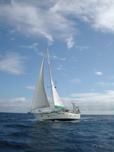
Tackless II |
|
Our planned course was to head west along the north coast of Upolu, go through the Apolima Strait between Upolu and Savai’i, then head south for Niuatoputapu. Because our winds never got above four knots while sailing along the coast of Upolu, we continued to motorsail.
When the sun came up, we were surprised to see Tackless II just behind us and about a mile toward the shore. They had been that unidentified radar blip behind us! We have enjoyed sailing a few legs with them, and although we didn’t know they were leaving at the same unsavory hour as we were, we looked forward to sailing with them again.
Even though we continued to motorsail the coast of Upolu, it was still a nice sail. The lush green island was really quite beautiful in the early morning light.
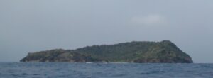
When we got to Apolima Strait, our winds immediately picked up to 14 knots, so we were able to turn off our engine. Blessed quiet. We passed Apolima Island, out in the middle of the strait, and it looked idyllic. It had a lovely bay with small breakers on a white sand beach. Picture perfect.
Tackless II caught a fish about that time, so she slowed to bring in the fish. We tacked and headed south hoping for another 24 hours of good sailing. It was not to be.
 | |
Apolima Island |
We were sailing to weather, but not hard on the wind. The seas were moderate and slightly confused, but not particularly so. So we don’t know exactly what got us or why, but we were both seasick. We have been sailing together for more than a decade, and this is the first time the former fish slayer – now known as fish feeder – has visited the rail. And we continued to feel terrible.
Our log has no entry from the time we passed Apolima Island (9:20 am local time) until we dropped our anchor at Niuatoputapu 28 hours and 10 minutes later. Neither of us could go below long enough to make an entry. We also didn’t pay much attention to our navigation, and we wandered a few miles westward which cost us time in remaking the easting. But we arrived Niuatoputapu at 1:30 pm – a very long 33-1/2 hours after leaving Apia.
It is hard to believe that about our last passage – from American to Western Samoa – we wrote, “It would be nice if all passages were this quick and smooth.” About this one we can say that we wouldn’t be doing this if all passages were this miserable.
In case any one is doing the math, we know that 4:00 am on August 30 until 1:30 pm on September 1 is more than 33-1/2 hours. Although Tonga is physically east of the dateline, they choose to consider themselves west of it. So August 31, 2005, never happened in our lives. Considering how we felt on August 30 and September 1, it is just as well.