MALDIVES
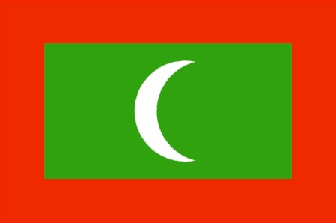
The Maldives are an island nation in the northern Indian Ocean. The official name is Dhivehi Raajjeyge Jumhooriyyaa – or Republic of Maldives.
Archeological finds suggest that some of the Maldive islands were settled in the 5th century BC by Buddhists from Sri Lanka and southern India. However, there are no written records before the 12th century when Islam was adopted in 1153.
The Portuguese repeatedly attacked Male in 1513, 1558, 1631, and 1649, but they ruled only briefly from 1558 to 1573. There was also a severe pirate attack in 1609. Then the islands became a sultanate under Ali Raja of Malabar in 1752.
Many of the islands were devastated by a hurricane and famine in 1818. Then the British arrived in 1835 and did their first survey by the British Admiralty. The islands became a ‘liberal protected state’ of Britain in 1887.
The Maldives developed their first written constitution in 1932, and they declared themselves a republic in 1953. However, they dissolved the republic that same year and returned to being a sultanate.
They finally achieved independence in 1965, and they declared themselves a republic for the second time in 1968. All British forces withdrew in 1976. The joined the Commonwealth in 1982.
The Maldives are a chain of atolls running north-south from just below the equator to a point 539 miles to the north. They are a continuation of an underwater mountain chain linking India’s Lakshadweep Islands to the north and Chagos Archipelago to the south.
There are 1192 islands comprising 26 atolls. Some atolls have as few as one island; some have as many as 250 islands. Although these islands comprise only 115 square miles, they are spread over 90,000 square miles of ocean. Two hundred islands are inhabited and are off-limits to tourists. Ninety islands are designated ‘resort islands’, and tourists are allowed to visit.
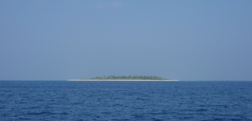
Typical Maldive island
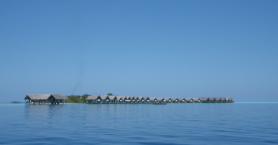
Typical Maldive Resort
Our plan was to visit only one island – Uligan – in the northernmost atoll of Ihavandiffulu. However, our plans changed – considerably. We ended up spending two months cruising the Maldives.
We had not planned to cruise these islands, so we were unprepared. We had charts, but we did not have any cruising guides or further knowledge. The Maldives have a reputation for not being ‘cruiser friendly’, and that was consistent with many of our experiences. A bit more information early on would have been a big help to us. But we got our hands on digital copies of two cruising guides as we went along, and life became a bit better.
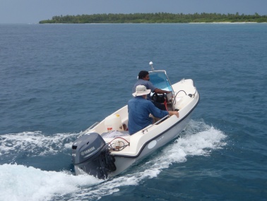
We sailed from the northernmost atoll down to the capital of Male which is about in the middle of the island chain. Then we sailed further south as far as the Fulidhoo Atoll. We did this in day sails, and we made numerous stops along the way. It was only 205 miles from our northernmost stop (Uligan) to our southernmost stop (Fulidhoo), but we wandered east and west a bit as we traveled. We will mention the islands we visited.
Uligan is the northernmost island in the Maldives. Checking in here was efficient and pleasant. The officials came out to the boat, and we were checked in within half an hour. Technically boats are to stay here no longer than three days; however, the officials have become more lenient in recent years. We were told that if we wanted to stay longer, we should still check out in three days, but we could request an extension for ‘mechanical’ reasons. We had still not located our fuel leak, so we felt that we were not stretching the truth too much in requesting an extension.
There is one small village on Uligan. There are no cars or motorized vehicles. There are only wide walking paths of sand, and most buildings are made of coral block. Fortunately the locals have learned to value their coral reefs, and they no longer blast them for coral block. Newer construction uses concrete block.
There is no agriculture on the island. There are some breadfruit and mango trees, but there are no vegetables grown locally. And there is a noticeable lack of animals on the island. No dogs, cats, chickens, cows, goats, sheep, etc. Nothing. All food is imported.
There is also no work other than the few government jobs and the current construction of a new mosque. We thought it interesting that, despite the lack of employment, Bangladeshi workers were imported to build the mosque because the locals would not work for the wage offered.
The island’s population is 487. There were four births and two deaths last year. Life moves at a very slow pace.
This is a Muslim community, and the women dress accordingly. They are completely covered; however, their faces are not veiled.
There are three small stores, and the supplies are limited. Fortunately, a supply boat arrived the day after we did, so we got a few fresh vegetables.
We wanted to make a few dives (Maldive Islands has been on Bud’s ‘bucket list’ for a long time!) and get the boat ready for the long sail ahead of us. First we must find and repair the diesel leak.
Years ago, Bud moved many components in the engine room so that they would be accessible underway. However, the fuel lift pump was not moved. It remained on the back side of the engine where one must lay across the engine to see it. A fitting on the fuel lift pump was the source of our leak. Bud had not been able to lie across the hot engine while underway to see this. What a relief…
With our leak repaired, we took on additional diesel so that we could start our long passage fully loaded with fuel. It was time to dive.
From the boat we saw many squid, manta rays, turtles, and dolphins. We did our diving inside the lagoon. It was nice, but not spectacular. We were pleased to see that the reefs have experienced only minimal bleaching, and the reef fish populations are very healthy. We surely would have thought it better if the visibility had been better, but it never exceeded 60 feet, and it was usually less. But still nice diving.
We planned our route from the Maldives to Salalah, Oman, and we planned to leave on the morning of February 21. We were full of fuel and food, and the boat and its crew were ready. Then on the morning of February 19 – just 48 hours before leaving – we got word that a sailboat had been pirated in the area where we were headed.
Fish Slayer Strikes Again
All of the cruisers planning to transit the northern Indian Ocean and Red Sea this season were well aware of the piracy issues. And, like us, most planned on getting as far as Salalah, Oman, then forming a convoy to transit the Gulf of Aden. However, in recent months the piracy problems had spread east across the northern Indian Ocean, and the danger zone was no longer restricted to the Gulf of Aden.
Some of the cruising boats in Cochin, India first investigated the option of shipping their boats, rather than sailing through these increasingly risky waters, and a few of them made that choice. At that time, we thought they might be overreacting to an imagined risk because at that point, no sailing boat had been seized in that area in six years. Then Quest was seized.
We knew immediately that we would not sail through there, and we knew within a day that we would pursue the shipping option. Then Ing was seized and the Quest crew was killed. The adventure began.
We have discussed shipping Passage from the Maldives to Turkey on a separate page. Our time in the Maldives continues on this page.
One would think it rather simple to day sail from island to island in the Maldives. Not so. There are two complications – ownership and depth.
Almost all islands in the Maldives fall exclusively in to one of three categories – resort, inhabited, or uninhabited. The entire resort islands – including the surrounding waters – are fully under the control of the resort, and most resort islands will not allow cruising boats to visit. A few will allow boats to visit, but the boats must pay the prevailing rate – as much as $150 per person. The government forbids tourists to visit all but a few inhabited islands in an effort to avoid ‘contaminating’ local culture. So that leaves only the uninhabited islands as available anchorages. However, our cruising permit does not include any uninhabited island anchorages – only resort islands. That creates a bit of a bind. We will figure it out as we go along.
Being atolls, the exposed land (islands) is surrounded by coral reef and steep drop-offs. Neither of these are conducive to anchoring. Obviously we do not want to drop an anchor on coral. Nor do we want to anchor in more than 100’ of water. This limits the anchorages available even on the uninhabited islands. These islands are quite beautiful, but they are not very ‘cruiser friendly’. Nonetheless, we did visit thirteen islands in six atolls during our two month stay.
We started a slow trip south toward Male. Our first stop was only 17 miles away at Dhonakulhi Island in the Tiladummati Atoll. This entire island is leased by Island Hideaway Resort. Another boat that had previously visited here told us that the management was ‘cruiser friendly’, and we found that they were. They allowed us to tie up to one of their moorings, and we had access to all facilities on the island. In return, we spent a few dollars on the island (easy to do at $8 + taxes per beer).
This is a very nice resort on a beautiful island. However, our watermaker had died, so we were focused on repairs (again) rather than play.
Here is the first time we saw an interesting fishing technique that we would see again on other islands. A medium-sized fishing boat (35-50 feet) cruises very slowly over shallow reef at night with bright lights illuminating the reef just in front of the boat. Outriggers are extended on each side of the boat. From each outrigger were three tethers dropping down to the water, and a snorkeler was attached to each tether. The boat’s outriggers dragged the snorkelers along, and they dove down to grab sea cucumbers off the reef. We never did determine how they release themselves from the outriggers enough to dive. Seemed a very unusual technique to us.
We got the watermaker working – kind of – so we continued heading south after three nights at this pleasant stop.
We were told that we could buy a SIM card for our aircard on Kulhuduhfushi, and we could then have occasional internet access on the boat. We needed to start making plans for traveling to Istanbul, so this seemed a necessary stop.
Kulhuduhfushi was bigger and busier than we expected. There are two small harbors with lots of fishing boats and commercial traffic. The fishing boat harbor is spacious, but we were not allowed to enter there because we are an international vessel. The commercial harbor is small, and we had to anchor there. We would much prefer to rub fenders with a fishing boat than a tanker, but that was not our choice.
Ashore we found more sand – lots and lots of sand. We have not seen pavement since Sri Lanka. There were a few cars and motorbikes.
We walked around town and across the island. One can stand on one side of the island and see the water on the other side. We wandered through residential areas trying to get some idea how people live here. There are businesses here, and it appears that many locals have jobs. This is quite different from Uligan – much more developed.
We had our first local food (no restaurant on Uligan), and it was pretty good. There is an Indian influence, but it is a much milder version.
We were also able to buy a few fresh fruits and vegetables there. They were quite expensive (more than $4 for a hand of bananas), but sometimes we will pay just about anything for freshies.
But our favorite thing about Kulhuduhfushi was the rain. It poured our first night there. Our boat is still not clean of cement it acquired in Sri Lanka, and it has accumulated lots of ‘road grime’ since. Much of it was washed away by a highly welcome downpour.
But we don’t like hanging out in commercial harbors. This harbor also had many hungry mosquitoes. We left after two nights there.
This was probably a stunning piece of sand a few years ago. It is a small crescent on the lower end of the Tiladummati Atoll. It is less than 400’ wide north/south and less than a mile east/west. It is surrounded by healthy shallow reef, and one must look very closely to see another island. It is quite isolated. But a very large resort is under construction on this island.
We were able to anchor here because the resort is not yet open. It appears that only construction crews are on the island.
We were greeted by many large dolphins, and we looked forward to diving on this reef. But first our chores.
Our watermaker continues to give us problems, and our laundry was mounting. We are having trouble getting the salinity in our water down to an acceptable drinking level, but it is adequate for bathing, cleaning, and the dreaded laundry. However, the anchorage got quite rolly, so we decided to move on after two nights without exploring here.
Bud & Hussein
We moved another 50 miles south to a small uninhabited island on the southwest rim of the Fadiffolu Atoll (still about 70 miles north of Male). The island is approximately circular with a diameter of about 500 feet. It is heavily wooded with shallow reef all around it, but there are a few sandy patches in which one can anchor. We anchored on the ocean side rather than in the lagoon.
The anchorage got a bit rolly, but we rode it out knowing that we would soon be in the noisy crowded anchorage in Male. We can tolerate a mild roll in exchange for the peaceful quiet of this island.
We went exploring by dinghy, and we were surprised how shallow the surrounding reef is. We had to be very careful not to bottom out. And it turns out that the best looking reef around the island is near our boat.
We had a little weather blow over, but it was not enough to clean the boat like the downpour of a few nights prior. But the clouds did create a stunning sunset.
On our second morning there, a local boat with one person aboard stopped by. He introduced himself as Hussein Mohammed. He had two items on his agenda: 1) his new outboard engine was overheating, and 2) he brought us two breadfruit. Bud was able to fix his engine problem (sand plug), and we invited Hussein on board for a visit.
Hussein speaks English quite well. We learned that twenty years ago he worked on container ships. He has visited three ports in the United States – Galveston, Long Beach, and New York. He must have a very unique perspective of the US. He and Bud became instant buddies.
Hussein lives on an island three miles north of where we were anchored. He took Bud to his island to get another internet card and some fresh veges. Bud met many local men, and he was impressed with their friendliness and warmth. Hussein thought we should move our boat to his island.
We spent one more night on Varihuraa, and it was a bumpy one. Thunderstorms were all around us, and we did not get much sleep. We moved to Hussein’s island in the morning.
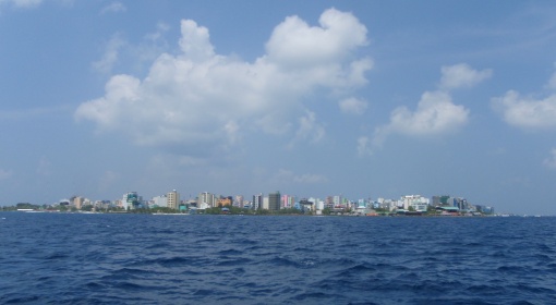
Male – much bigger than we expected
Hussein showed up early in the morning and tied his boat to the back of ours. We weighed anchor and headed north. Hussein wanted the helm. We anchored just off the small harbor.
Kurangdu has a population of 1,800. There are a few stores, much boat building, and a nice new hospital. Like other inhabited islands we have visited, most of the buildings were constructed of coral block, but new construction is using concrete block. The ‘streets’ are sand walkways.
Bud and Hussein went for a morning snorkel, and Hussein said that his wife would like us to come for lunch. We did not yet have much of an understanding of local Maldivian food, so it sounded good.
When we went ashore, we went aboard a large (100 foot?) wooden boat being built on shore. We went through the hospital and met their only physician – a very interesting Indian man. We walked through the village, then Hussein’s wife – Hamina – said lunch was ready.
Lunch was unbelievable. We did not count, but there must have been at least ten different dishes. We had a few different types of local curries, local vegetables, and rice. It was a delicious feast. We later learned that she got up at 0500 that morning to start cooking.
That evening Hussein, Hamina, and two of their children came out to the boat. They also have two older sons that are working in some type of apprentice programs at local resorts learning resort management, and we did not meet them. But we met their two younger children – ages five and eleven. We had a very nice evening on board.
We needed to continue our travels southward, so we left the next morning. However, as we left Kurangdu, we felt as though we were leaving special friends. Hussein and his family have been the highlight of our visit to the Maldives. We will remember them.
Fifty miles south we stopped at Makunudhoo Island. This island is in the northwest part of North Male Atoll – the atoll in which the capital of Male is (in the southeast). The island is leased by Makunudu Island Resort. It is a relatively small resort with only 36 rooms.
This island has extensive reef to its west, and one must navigate carefully to make their way in toward the island. However, we found the charts quite inaccurate. Although the positions of the reefs were relatively accurate, the depths were not. We found ourselves in 20 feet of water once when the chart indicated we should have had more than 100. But in areas with reef, we always rely on eyeball navigation, and we were able to see our way in.
We stayed at Makunudhoo Island for three nights. Bud snorkeled once and found the corals badly bleached and in overall poor condition. However, he also found a hawksbill turtle that did not mind having company. Nita spent time cleaning and cooking. We both were killing time before facing the onslaught of Male. But we also wanted to get to Male. We needed to renew our visas and cruising permits, and we needed to clean our watermaker membrane. So we planned to leave on our third morning.
As we were getting ready to leave, we received a radio call from friends on Roam II. They had sailed overnight, and they were a few miles north of the anchorage. They had lost their windlass, so they were looking for a shallow anchorage. Not likely at Makunudhoo, but they wanted to come in and look around. We waited until they arrived.
Roam II quickly decided that this was too deep to anchor without a windlass to retrieve their chain, so they decided to sail the 22 miles to Male with us. We were on our way by mid-morning.
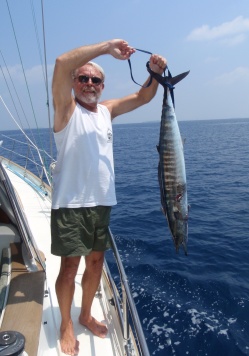
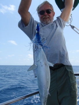
We had very little wind as we headed south, so we motored the entire way. About five miles north of Male, we hooked a twenty pound wahoo. This was our first fish in a while, so we were pleased. We looked forward to sharing it with others in the anchorage.
Most visiting boats – including all sailboats – are instructed to anchor at Hulhumale rather than Male. Hulhumale is a man-made island that was created to ease some of the overcrowding on Male. The project began in 1997, and it was inaugurated in May, 2004. It has been inhabited for almost seven years.
There are now multiple housing options, schools, public buildings, a hospital, mosque, and commercial buildings. More than 12,000 people live on Hulhumale.
We noticed that Hulhumale is the first paved road we have seen in the Maldives. But there is also much sand remaining.
Hulhumale is connected to the airport island by a causeway, and it has a busy ferry terminal from which one can travel to Male in 30 minutes for less than $1 USD. Male is one mile away.
We went across to Male the following morning. This is a very compact city, and it is much taller than we expected. We saw numerous buildings with eight to ten stories. In the outer islands, we had seen only sand – no pavement whatsoever. On Hulhumale, we saw both sand and pavement. On Male, we saw only pavement. There may be a patch of sand or a beach somewhere, but we did not see it. Very densely built.
We needed to take care of our business. Our telephone SIM card had stopped working, so we had to seek out a replacement. Then we called our agent to start our renewal processes. He said he would meet us, but he did not.
Meanwhile, we got another internet SIM card and service package (the service we got in Kulhuduhfushi was not very user friendly). After a few more phone calls, our agent finally came to meet with us. We were troubled that he was being dishonest with us about what we had paid when we bought our cruising permit. We chose not to confront him on this dishonesty because we needed him to facilitate the renewal of our visas and cruising permit, but we were troubled.
Our interactions with our agent soured our moods, so we decided to do only the minimum and return to the boat. We bought a few freshies and decided to stop for lunch. We had an ok (albeit overpriced) lunch and we returned to Passage.
The dreaded chore of cleaning our watermaker membrane went much easier than we anticipated. It did not cure all our watermaker woes, but it helped. At least we could safely leave Male and feel confident that we could make enough water to keep ourselves going.
We returned to town a few times and enjoyed it much more. There is a lot to see if one roams around.
We had to return to our agent’s main office to pick up our renewed visas and cruising permit, and with the documents in hand, we mentioned our problem of having been overcharged $80. To our pleasant surprise, they reduced our renewal fees by $80. They were not pleased to hear what the local agent had charged us, and they did not question our honesty about it. We were pleased.
So with some fresh food on board, it was time to head out again. We did not find much appeal to the airport anchorage.
Enboodhu is on the northeast corner of South Male Atoll. This is the location of the Taj Exotica Resort, but we did not go ashore or even anchor near the resort. It is a large shallow lagoon, and we anchored well offshore.
Enboodhu is known for its high-intensity drift dive through the channel on the southeast of the island. Of course, we had to do it. Sorry to say we were disappointed. The visibility was poor, and we didn’t see anything of any interest. We also snorkeled a shallow reef in the lagoon that was nice but nothing special. The reefs have lots of fish, but the coral is not in good condition. Moving on…
We planned to move just a few miles south to Gulhi or possibly Guraidhoo in the same atoll, but we did not find anything of interest, so we continued south to the next atoll – Fulidhoo. The pass entering in to the atoll was shallow, and we found a minefield of bommies once inside, but we made our way to Fulidhoo Island on the northwest corner. We anchored well offshore of this tiny island – probably a half mile off.
This became a good place for us to just hang out for a while. We did not even go ashore until we had been there a week. We did a few boat projects, read, jumped in the water when it was unbearably hot (most days). We don’t get enough of these relaxing times.
And Again
In the water we saw large sting rays, an eagle ray, and a whale shark. There were the usual reef fish, and the reefs here were also in only fair condition.
After a week on the boat, we made one trip ashore. All sand again without any motorized vehicles and only a few bicycles. As usual, the people were friendly, but most spoke very little English.
We stopped at their only ‘café’ and had tea and snacks for less then $2. Here, as in Kurangdu, there is an Indian physician on contract. He stopped by the café and introduced himself, and we chatted with him for an hour or so. We learned that the population is approximately 350, and this is the first time there has been a physician on island. We also learned that there are two highly polarized political parties, and they do not talk to each other. That really limits your social circle on an island of so few people! Fulidhoo, like Uligan, is building a new mosque. And, like Uligan, the construction crew is Bangladeshis. The locals just don’t want to work! We bought a few things at the market and returned to the boat.
We decided that we would not go any further south, but we were ready to move on again. We would return to the northern atolls.
We headed back north again and entered the South Male Atoll. We had thought about visiting Guraidhoo about ten days earlier, but we did not see the pass through the eastern reef, so we continued on to Fulidhoo. But having entered the atoll from the south, we easily made our way to Guraidhoo. We caught a small tuna along the way.
The anchorage was deep (at least 50 feet), and it was crowded with dive boats, so we thought this might be a brief stop. But we wanted to visit the island and check out a few of the dive sites.
The island has 1,600 residents. It is all sand without any motorized vehicles, and it is non-descript other than the street of souvenir shops. There are probably twenty of these shops catering to the numerous dive boats that stop here, but only a few were open when we went ashore. We were surprised that most of the souvenirs being sold are not from the Maldives. They are the same items we have seen imported to all the island countries from the mid-Pacific westward.
We had lunch at the local café, and it was ok – fried rice and fried noodles. And we bought a little food at one of the grocery stores. We were adequately provisioned to spend another week offshore, and that was the plan.
Before leaving, we wanted to check out a few local well known dive sites. Again, most of them were quite pedestrian. The coral is in poor condition. We did drift in one channel that had some living coral and increased fish populations, but it was still far from what we expected. Now we were ready to head further north.
This was our last stop before we returned to the Male area. Velassaru is in the northwest corner of South Male Atoll from where we could see Enboodhu to the east and Male to the north. Velassaru is the site of the Laguna Beach Resort, but we did not visit the resort.
We snorkeled a few spots on the reef south of the resort, and we found it similar to most of what we had seen elsewhere. There were fish, but the coral was in poor condition. The visibility was also limited to about 35 feet. We were not inspired.
We were aware of our time running short, and we knew we had much to do to get Passage ready for shipping, so we returned to the Male area after only one night. We were sorry to see our outer-island adventure end, but we were ready to move on.
Hulhule is the island on which the Male airport is situated. Hulhule, Hulhumale, and Male function as one group, but they are actually three individual islands. In addition to the airport, Hulhule has the airport hotel. There are also related government offices.
We went to Hulhule to check out the airport and hotel as we planned to leave the Maldives. The airport was small, but we don’t ask much of airports. We were, however, a bit disappointed in the hotel. It is not cheap, but it is boring. It had no character at all, and we could not see why anyone other than flight crews would want to stay there. We enjoyed seeing the sea plane area. Most of the traffic to the resorts in outer islands travel by sea plane. But other than going to the airport, we saw little reason to return to Hulhule.
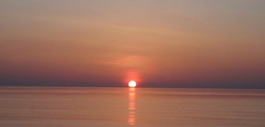
Beautiful Sunsets
Although certainly not planned, we ended up spending two months in the Maldives. We visited twelve islands in six different atolls. We felt as though someone had thrown a bucket of lemons at us, and we were determined to make lemonade of them. We did our best to make the best of a bad situation, and we did ok.
Now it was time to get Passage ready for shipping. The loading and shipping experience was trying – to say the least!
Follow Passage on her big adventure being shipped from Maldives to Turkey or jump ahead to our arrival in Europe and Turkey.