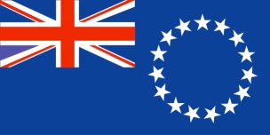
COOK ISLANDS

Our first south pacific destination was the Cook Islands. There are 16 Cook Islands spread out over almost one million square miles of the Pacific Ocean (from 8º S to 23º S and from 156º W to 167º W). However, the land mass of the islands is less than 100 square miles, and two islands – Rarotonga and Mangaia – make up over half of that land mass, so the other 14 islands are quite small in a very large area of ocean.
The Cook Islands were probably first populated by Polynesians from Tahiti in the first century A.D. In the second century A.D., Tahitians sailed through the Cooks as they traveled between Polynesia and New Zealand, and they introduced New Zealand Maori culture to the existing Polynesian culture. The Cook Islanders describe themselves as Polynesian Maoris, and their culture and language is a blend of Tahitian and New Zealand Maori.
Although the islands were seen by Spanish explorers in 1595 and 1606, Captain Cook is credited as the “discoverer” of the islands in 1774. An equally profound date in their history is 1823 when the London Missionary Society first arrived the islands. They quickly converted the native population to Christianity, and the church became the dominant force in the Cook Islands. The Cook Islands Christian Church evolved from the London Missionary Society, and the church continues to exert its influence on the social structure of the islands.
Politically, the Cook Islands became a British protectorate in 1888, and administrative responsibility of the islands was assumed by New Zealand in 1901. In 1965, the islands became self-governing in free association with New Zealand.
Cook Islanders are citizens of New Zealand, and as such they can travel to New Zealand and Australia without restriction. The island population continues to decrease as more migrate to New Zealand and Australia. Although the Cook Islands has a population of approximately 20,000, two-thirds of the population lives in the capital – Rarotonga. There are probably less than 6,000 islanders living on the 15 islands outside of the capital.
The islands geographically divide in to two groups – a northern and southern group – with eight islands in each group. The southern group has an agrarian economy and a few small manufacturers of jewelry and clothing. However, the northern group has limited sources of income. Most men fish and make pearl shell jewelry, and virtually all women weave hats, fans, and even jewelry. The weaving in the Cook Islands is intricate and beautiful.
Education is free and mandatory for children ages six through fifteen. Children begin learning to speak English in the third grade, and most islanders speak some English.
We did not plan to visit the eight southern islands which include Rarotonga and Mangaia – the largest islands. But we did want to visit each of the eight northern islands – actually seven atolls and one island (Nassau).
We learned that only two of the atolls have navigable passes with inside anchorage – Penrhyn and Suwarrow – so we put them on our itinerary. We were told that Rakahanga and Manihiki lack navigable passes but have outside anchorages, so we also put them on the itinerary. When we learned that three of the atolls – collectively known as the Danger Islands – lack a navigable pass and outside anchorage, we realized that we could not go there. And Nassau was too far west to fit our planned route. So our plan was Penrhyn, Rakahanga, Manihiki, and Suwarrow.
As it turned out, we spent time on Penrhyn, then we sailed to Rakahanga where we could not find safe anchorage (too deep). So we sailed on to Manihiki, and again, we did not find safe anchorage. So we headed on to Suwarrow. In the end, we actually spent time on only Penrhyn and Suwarrow, but we had some interesting experiences on both of them.
Read about our stay on Penrhyn, our sailing within the Cook Islands, and our stay on Suwarrow.