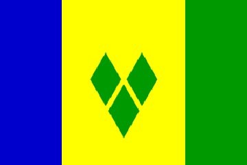
SAINT VINCENT AND THE GRENADINES
Saint Vincent and the Grenadines (SVG) is a single nation in the Leeward Antilles. These multiple islands comprising one nation are south of Saint Lucia, west of Barbados, and north of Grenada. There is one island named Saint Vincent at the northernmost of the nation, and there are more than thirty small Grenadine Islands south of Saint Vincent island.
The original colonizers of these islands had migrated north from South America to Trinidad then Grenada then SVG. They called themselves Kalinargo, and they called the island of Saint Vincent Hairoun which means ‘home of the blessed’. Columbus visited Saint Vincent on his third voyage, and he gave the local population the name ‘Caribs’.
The local population changed during the 16th century as a result of the influx of formerly enslaved Africans. A shipwreck off Barbados contained enslaved Africans, and many of them escaped and made their way to Saint Vincent. Also, escaped slaves from Saint Lucia and Grenada sought refuge on Saint Vincent. This African population intermarried with the local population, and the result was the Black Caribs or Garifuna. This local population fiercely resisted European settlement until 1719.
In 1719, French settlers from Martinique gained control of the island. They began cultivating coffee, tobacco, indigo, cotton, and sugar. The French developed small plantations, and they used enslaved Africans for labor.
In 1763, the British took control of the islands, and the colonial plantation system expanded. The local population, however, resisted the plantations.
Arriving Bequia (photo by Kenmore Henville)
The French regained control of the islands in 1779, then the Brits regained control again in 1783. There was conflict between the Brits and the Black Caribs from 1783 to 1796, and the Brits deported more than 5,000 Black Caribs to the distant island of Roatan off the east coast of Honduras.
Slavery was abolished in 1834. However, the plantation system survived on the backs of imported indentured servants.
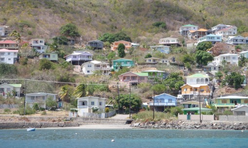
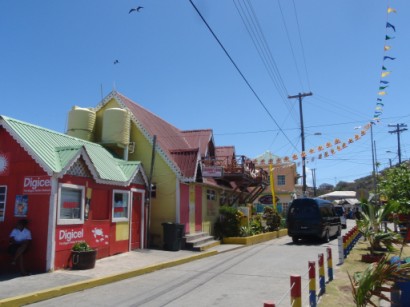
Typical local housing painted many colors
The islands passed through various forms of British colonial status until its independence on October 27, 1979. Saint Vincent was the last of the Windward Islands to gain independence.
In addition to colonization, slavery, and the plantation system, SVG has also experienced severe natural disasters. La Soufriere Volcano on the island of Saint Vincent erupted in 1812, 1902, 1973, and 1979. The 1902 eruption killed thousands. The islands are also in the hurricane belt, and in recent years they have been hit by severe hurricanes in 1980, 1987, 1988, and 1999.
The island of Saint Vincent is approximately 11 miles north-to-south and 6.8 miles east-to-west. Its land mass is 133 square miles. The Grenadines span 37.5 miles north-to-south, and their land mass totals only 17 square miles. The total land mass of the country is 150 square miles.
The islands are volcanic. The windward sides are rocky, and the leeward sides are mostly sandy beaches. The highest peak is La Soufriere Volcano at 4,049 feet.
The official language is English, and some speak a local Creole. The literacy rate is only 88%.
SVG’s primary source of revenue is agriculture – mostly bananas. They have been overly dependent on a single crop, and storms have caused financial chaos when the banana crop has been badly damaged.
SVG’s second source of revenue is tourism. The recent Pirates of the Caribbean movies were filmed on Saint Vincent, and they provided good exposure for tourism. SVG has banned the use of jet skis in their waters, and that appeals to many travelers.
Their currency is the Eastern Caribbean (EC) dollar. One US dollar is equivalent to 2.66 EC.
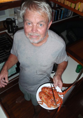
Fresh lobster for lunch
SVG is a constitutional monarchy, and Queen Elizabeth II is head of state. They are a parliamentary democracy with one legislative house. Their capital is Kingstown on the island of Saint Vincent, and they have no military.
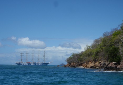
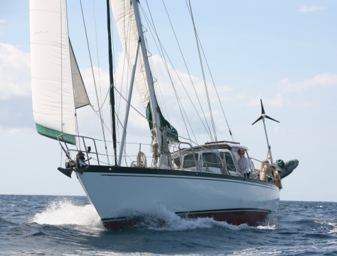
Sailing ship at Tobago Cayes
We had a great sail from Saint Lucia to SVG. It was fast, but not too bumpy. We averaged more than six knots including a lull off the west coast of Saint Vincent island.
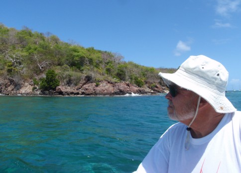
Saint Vincent island is pretty from the water. It is steep and very green. However, there has been a lot of crime against cruisers on the island. Most of it has been theft, but there have been some assaults. We decided to pass on by and go to Bequia.
We sailed 55 miles from Soufriere, Saint Lucia to Admiralty Bay, Bequia. A very nice sail.
The name Bequia derives from a Carib word meaning “island of the clouds”. When we arrived in Bequia, the only clouds were scattered light cumulus ‘trade wind’ clouds.
Bequia is only seven square miles, and its population is less than 5,000. Many of today’s inhabitants are descendents of Scottish sailors.
As we were approaching Admiralty Bay, Nita heard a whistle being blown. She looked around and saw an inflatable dinghy racing up from behind then crossing our bow. A single man was standing up in this dinghy as it bounced around. He appeared to have something over his shoulder. It took a minute to realize that this was Kenmore Henville of Bequia Photo Action. Kenmore makes his living taking pictures of boats arriving in Admiralty Bay. This is probably a lucrative business during the ARC when more than 200 boats arrive en masse. These are slower times.
There were a lot of boats in Admiralty Bay. Many were anchored, and many were on moorings. We had trouble getting our anchor to penetrate the weeds in Admiralty Bay, so we rented a mooring from Daffodil.
Daffodil has a marine service business with a good reputation. She sells fuel and water, does laundry, rents reliable moorings, etc. Her moorings are a bit further from town than others’, and we enjoyed that because we had no mosquitoes. We also had no internet, but we are getting used to that.
There is a small town, Port Elizabeth, at the head of the bay. It has a secure dinghy dock, and the town appears to be built to accommodate its visiting boaters. We found a few small grocery stores, and their prices were shocking. But this is the best provisioning we will find for a while, so we had to buck up and pay the going rate. (Bud is delighted to learn that it is much cheaper to drink good rum than lousy beer.) We visited the local chandlery and made our obligatory donation.
Exploring the cayes by dinghy
We had planned to leave after two nights, but the wind was blowing 33 knots in the bay on our third morning. So we decided to stay one more day. We just hung around the boat and did chores. A relaxing day.
On March 21, we motored eight miles around the west end of the island and back to the southeast corner. We were headed to Friendship Bay.
Out near the western tip is an interesting housing development called Moonhole. These are houses built out of rocks without straight lines or right angles. They follow the contours of the hill, and they appear to be rockpiles. Most do not have windows, and none have electricity. A unique development.
There was also a seemingly recent shipwreck on the western tip of the island. This was a fishing boat that went aground between the point and a small off lying islet. We don’t know the story of what happened.
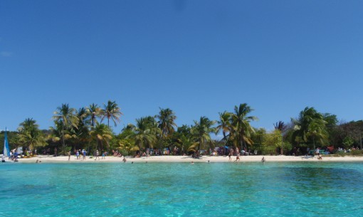
Nice beaches at Tobago Cayes
As we were approaching Friendship Bay, we had to pass between a few rocky islets. Petit Nevis was to starboard, and Semplers Cay was to port. As we were approaching the narrow pass, a small local fishing boat approached us. He had lobster for sale. We had 25 EC (slightly less than $10 USD) handy, and we did not have time to go below and get more money, so we offered to buy what he would give us for that amount. We got two beautiful lobsters.
There is a lot of grass on the bottom in Friendship Bay, so it took us a few tries to get securely anchored. But when secure, we had fresh lobster for lunch. Delicious!
An interesting bit about Bequia is that the locals are legally allowed to hunt and kill four humpback whales per year. The old whaling station was on Petit Nevis, and they now slaughter and process them on Semplers Cay. We were very pleased that there were no dead whales being processed while we were there.
In fact, there was not much at all going on in this bay. There are two resorts, but one has been closed for a few years. And although there are a few local houses built around the bay, we did not see any activity in any of them. It felt quite desolate. Just us and the roll.
The roll in this bay was terrible. We put out the flopper-stopper, and we still rolled uncomfortably. It was tolerable, but it was not comfortable.
Because of the high crime incidence throughout the Caribbean, cruisers are advised against anchoring by themselves in any anchorage. We had other boats come in our first night there. There were four or five of us. But we were the only boat there on our second night. That is not a good situation in any Caribbean anchorage, and it was a bit eerie in this desolate place. But we did not have any nocturnal visitors, and all was well.
We left Friendship Bay and Bequia on March 23. We had planned to go to Brittania Bay on Mustique, but that anchorage is known for being rolly. We could not handle another rolly anchorage, so we headed for the island of Canouan.
We had a very fast sail from Bequia to Canouan. We had a single reef in the main and the full #2 jib out on a mostly beam reach. The current was with us, and we covered 18 miles in 2 ½ hours.
Canouan is just five square miles in size. Their population is approximately 700.
We had read that Canouan is a divided island. The north has been developed in to a big budget resort – a gated community. The airport has been extended to accommodate private jets. The local population has moved to the south, and their lives are a bit less glamorous.
We had also read that there was decent diving around Corbay on the northwest coast, so that is where we headed.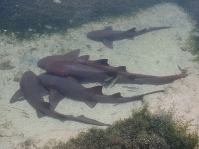
Nurse sharks
This small bay has a small dock (of sorts), and ashore is a backhoe and piles of dirt. Not particularly scenic. When we arrived there was no roll, but it did get a bit rolly later in the evening.
But we went there to dive, so we got in the water just north of where we anchored. The diving was ok but not great. The reef was in fair condition, and there were countless small reef fish. But the visibility was marginal (30 feet at best). We had not been in the water in a while, so we enjoyed the dive despite its shortcomings. We were again the only boat in the anchorage at nightfall. Not a good situation.
The next day, we moved a few miles south to Charlestown Bay where many boats were anchored. This was a very gusty anchorage, but we had plenty of room all around us.
We went ashore at the only town, and we found it dreary and depressing. There are more goats than people. And the people we encountered seemed unhappy. The two grocery stores had very little on their shelves. And the local produce was of lesser quality than we had been finding. (Where does the up market resort get its food? Fly it in?) A dreary place. We left the next morning.
Main Street in Clifton
We traveled seven miles to the Tobago Cayes. We sailed some and motored some.
There are many shoals and reefs around the Cayes, and careful navigation is required to get in and out. We were less than one half mile from the Cayes when a large squall blew over us. The wind blew 37 knots, and it was a complete white out. We knew there were shoals and reefs all around, and we also had half a dozen other boats underway and nearby. Squalls are always anxiety provoking, but this one was particularly stressful given our location and close neighbors. But it blew by quickly, and we continued on to a beautiful anchorage.
The Tobago Cayes are a group of small uninhabited islets just west of the island of Mayreau. Some believe they are the most picturesque anchorage in the eastern Caribbean. We would not argue with that.
There are four islets surrounded by Horseshoe Reef which is open to the west. Beyond Horseshoe Reef is the Atlantic Ocean. The reef dampens the seas coming across the ocean, but not the winds.
We anchored west of the two largest islets, and there were approximately 15 boats there. It was not overly crowded, and we were pleased with the small number of boats. But later we got in our dinghy and went to the eastern side of the islets, and there must have been 200 boats anchored and moored out there! It looked like a parking lot! From that anchorage, the wind kept the boats facing east, and the reef dampened the seas. The boats looked out over the Atlantic.
Another of the islets has a turtle watching area. We did not see any turtles on the islet, but we saw a few swimming including one just off our boat.
This is a very pretty place. This is what we had hoped to find in the Windward Islands. But a few days later, we moved on again. This time to Mayreau.
From our anchorage in the Cayes, we could see the masts in Salt Whistle Bay on Mayreau. We motored the two miles to this shallow anchorage.
Mayreau has a population of only 250. It has only one road between its two settlements at Salt Whistle Ba7 and Saline Bay.
This is a crowded anchorage, but it is quite pretty. From our boat we could see across a small sand spit with a few palms and out toward the cayes. There were kite surfers on the windward side of the spit. On shore were the usual stalls selling trinkets and a restaurant or two. We enjoyed a quiet night on board and left the next morning.
We motorsailed the five miles from Mayreau to Union with only a jib. It was a quick and easy trip.
Union is 44 miles south of Saint Vincent island, and it has an area of 13.7 square miles. Its population is approximately 2,500.
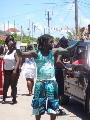
Dancing in the street in Clifton
It has a dramatic profile against the clear sky, and its highest peak is Mount Tabor at 1,000 feet. The rugged coastline has a few blowholes that were really spouting with the increased ground swell (two days past full moon). We headed for Chatham Bay near the northwest tip of the island.
Chatham Bay is wide open and inviting. There is room for many, many boats here and still privacy for all. We anchored out a ways in 27 feet of water. There is little to do in Chatham Bay, so we did little. We went for a few dinghy excursions and did a few projects. We mainly just enjoyed the beautiful scenery.
After two nights, we headed for Clifton – the main town on Union Island. Our winds steadily increased in to the lower-to-mid twenties, and a passing squall brought winds in the lower thirties. Fortunately the seas were small, so we powered through.
We anchored just west of Newlands Reef in Clifton Harbor. The weather remained squally (downpours with winds up to 35 knots), so we stayed put. But the weather did not discourage the many windsurfers and kitesurfers on the reef. We enjoyed watching them.
Ashore we found colorful and friendly locals. We enjoyed town, but the shopping was not too good. We found adequate fruit shopping, but little else.
After three nights in Clifton, we were tired of the rolling anchorage, and the weather had settled a bit, so we checked out. We decided to go to Hillsborough on Carriacou (northern Grenada) because it appeared to provide some protection in the anchorage. We left SVG by mid-morning.
Return to Saint Lucia, follow us to Grenada, or go to our Caribbean page.