SAILING TO NEW ZEALAND
The passage from Tonga to New Zealand is just over 1,000 miles. Our planned port of entry, Opua, New Zealand, is over 850 miles southward and almost 650 miles westward. Therefore, we planned 7 or 8 days at sea. When one spends that many days at sea and traverses that many degrees of latitude, weather changes are likely. Also, this passage has a reputation of occasionally slamming a few boats. So we wanted to do everything we could to optimize our weather conditions.
Throughout the months of October and November, the VHF radio frequencies in Tonga were almost constantly abuzz with boats discussing weather information with each other. Cocktail hour and dinner conversations were about weather as well. And at times, it seemed an information overload from which it was difficult to extrapolate the relevant information. We needed a plan.
Of course, we downloaded weather faxes and GRIB files daily, and these provided us with good information about the conditions near us for the next few days. But how do we predict what we will find many degrees south and west a week from now?
Weather forecasts were being discussed from four sources. First was Bob McDavitt with New Zealand’s Metservice. He is New Zealand’s weather guru, and he has an excellent reputation for both forecasting weather and routing sailboats to maximize their passage (at the rate of $120/hour). Second was “the commander”. We don’t know who the commander is, but for a small fee, he will send an e-mail advising departure at what he deems the best time. Third was Don on SV Summer Passage. Don is a kiwi living in California who keeps active in the cruising community via radio nets. He provides forecast information without charge to anyone asking. And fourth was Winfred on ‘the German net’. This net is German-speaking, and it has a large following. We do not know Winfred’s credentials, but his service is also free. This abundance of information should have simplified our decision on when to leave and what course to sail, but it only complicated it as the sources often disagreed. So we had to decide in which source we would place our trust. After reviewing the known credentials of the sources, we decided to hire Bob McDavitt to help us plan our passage.
The original forecast/routing advice we got from Bob was to leave Tonga early on Thursday, November 24 (Thanksgiving), and sail very near the rhumbline to Opua. However, this info was a few days old, so we wanted to verify that this was still his advice. Ah, the frustrations of SailMail… We were not able to access our e-mail on Wednesday – the day before leaving – and we were still unable to access it on Thursday until we had been underway for seven hours. And, based on weather changes in the Tasman Sea, his advice to us had changed. He now advised us to stop at North Minerva Reef – a very odd place about 250 miles southwest of Tongatapu – for 24 hours to allow a system to blow east ahead of us. We arrived Minerva Reef early Saturday morning with plans to leave on Sunday morning and continue south.

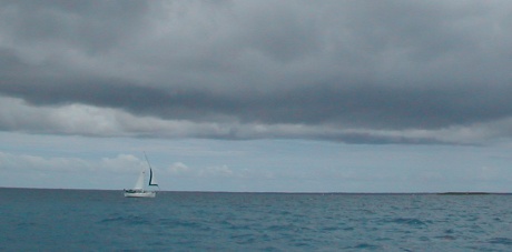
SV Novia under a threatening sky
Our friends, Dale and Heather, on SV C’est la Vie, had been hanging out at Minerva for about a week before we got there, and we stopped to talk. Of course the conversation was dominated by weather. They told us that they, too, had hired Bob McDavitt, and earlier that morning he recommended that they not leave Minerva until Tuesday. This was inconsistent with our information that was now a few days old. Passage sails about a third again as fast as C’est la Vie, so if we were to leave at different times, Passage should leave later, not sooner. So we sent another e-mail off to Bob (can you hear the meter ticking?).
The system below us was very slow moving, and he now advised us to stay at Minerva until Wednesday, November 30. So we settled for a four day stay.

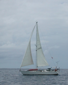
Sailing alongside SV Nokomis
These four days were a bit anxiety-provoking for us. We listened to the “New Zealand or Bust” radio net where boats would check in twice daily to report their position and conditions. The fleet included boats that left before us and three boats that left with us but chose not to divert to Minerva. Some of them were getting pounded. Hearing what they were experiencing was not comforting.
Wednesday came, and we headed south in the company of two other boats that had diverted with us – SV Nokomis and SV Novia (C’est la Vie had left on Tuesday). We were a bit anxious about the weather, but we believed that we had done the best we could by hiring Bob and updating our information daily, so we headed south prepared to take whatever we got along the way.
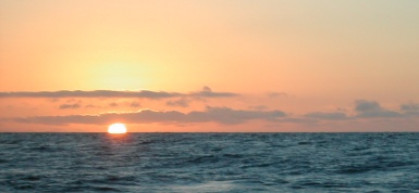
On leaving Minerva on Wednesday, we motored a few hours to find winds, then we raised our sails and had nice sailing. Thursday and Friday were a bit uncomfortable – choppy confused seas with winds 20-25 knots. Saturday was as good as it gets, but the winds decreased Saturday night, and we had a miserable night of slatting sails and slamming rigging (we really should have motorsailed). We motorsailed Sunday. We again got our sails up by late morning on Monday, and conditions got a bit boisterous Monday night. But we pressed on and arrived the Bay of Islands on Tuesday morning. Watching the sun rise behind Cape Brett was quite a welcome!
We never saw sustained winds over 28 knots, and the largest gust we saw was only 34 knots. Although the seas were uncomfortable at times, they were never dangerous. So, all in all, we had a very good passage. And we would highly recommend Bob McDavitt for forecasting and route planning in these southern latitudes.
Our regular readers (hoping that we have one or two) will note the lack of fish slayer’s picture on this page. He did not fish during this passage. New Zealand has very rigid quarantine rules on bringing foods in to the country. The information available to us states that no fresh or frozen ‘meat’ can be brought in, so we assumed that we could not bring in any fish that might be caught along the way. But he will be back out there soon.
Follow us to New Zealand.

Our First Sunrise in New Zealand