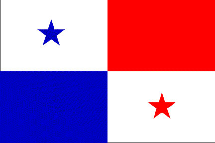
PANAMA

The Republic of Panama is a narrow isthmus that divides the Pacific and Atlantic Oceans as well as the two halves of the American continent.
Archeological finds suggest that the isthmus has been inhabited since at least 2500 – 1700 BC. In pre-Colombian times, the area was settled by Chibcan, Chocoan, and Cueva peoples. Most of these fled to the jungles and islands when the Spanish arrived in the early 16th century.
Christopher Columbus ‘discovered’ Panama in 1502 on his fourth voyage, and he claimed it for the Spanish crown. Panama would remain part of the Spanish empire from 1538 till 1821.
The first governor appointed to Panama was Vasco Nunez de Balboa, and he profoundly changed the fate of Panama when he trekked across the isthmus to the Pacific Ocean in 1513. He showed that South American gold and silver could be shipped north along South America’s west coast then hauled over land to the Caribbean Sea. Those riches were then loaded on ships destined for Spain. Panama became Spain’s New World crossroads and marketplace.
Vast riches passed through a few Caribbean ports – most notably Portobello. However, Spain had little control over much of the territory outside of their small settlements. They were vulnerable to pirate attacks. And pirates did attack including Henry Morgan who sacked and burned Panama City in 1671.
Northern South America feared other Europeans would try to take Spanish territory, and they joined forces by forming the viceroyalty of New Granada in 1717. Panama fell under its jurisdiction.
By the mid-18th century, Panama’s importance was decreasing as Spain’s power was decreasing. Advances in navigation were enabling ships to sail around Cape Horn to reach the Pacific Ocean. The Panama route was shorter, but it was very labor intensive. The land route across the isthmus regained popularity during the California gold rush, and the railroad was built. But the need for a better option persisted.
Wars for independence from Spain were occurring across Latin America during the 19th century, and Panama declared its independence from Spain in 1821 when it became part of Colombia. It remained a part of Colombia until 1903 when it agreed to the Hay-Bunau-Varilla Treaty with the US. This treaty gave the US sovereign rights to a 10 by 50 mile piece of land through which they could build the canal. In exchange, Panama got the support of the US for its independence from Colombia.
A superb history of the Panama Canal – “The Path Between the Seas” – has been written by David McCullough, and it is highly recommended for anyone wanting a bit of knowledge about this amazing endeavor. But for the purpose of this webpage, only a brief overview of its history is given, and that is on our Panama Canal page.
The late 1960s ushered in political chaos that would severely shake Panama. In 1968, Arias Madrid was elected president amid accusations of fraud. Ten days later, a military coup by the national guard ousted him from office. In the early 1970s, General Manuel Noriega was in control of the military and government, and the US supported his military dictatorship. In 1987, civil disobedience began, and the military declared a state of emergency and suspended many constitutional rights. Massive demonstrations were violently repressed. The US no longer supported Noriega, and US President George H. W. Bush began imposing sanctions on his regime – sanctions which have been reported to have hurt the Panamanian people far more than Noriega. In 1989, Panamanians voted against Noriega, but he annulled the election and increased the repression. Then-president Bush authorized the invasion “Operation Just Cause” which ousted Noriega. Post invasion, the 1989 election results were reinstated. Since then, Panama has been on a gradual path away from corruption and toward transparency.
Panama is part of Central America. It is an isthmus of land connecting Central and South America. Costa Rica is to the west, Colombia to the southeast, the Caribbean Sea to the north, and the Pacific Ocean to the south. It is comprised of 29,119 square miles with a rugged landscape. There is a central spine of mountains, and its tallest peak is 11,401 feet. There are nearly 500 rivers, but most are not navigable. There is nearly impenetrable jungle near the Colombian border which causes the only break in the Pan-American Highway. The tropical climate is hot and humid.
Panama is a presidential representative democratic republic. The president is the head of state and government. Panama just had its fifth peaceful presidential election on May 3.Panama is divided in to ten provinces and five comarcas. The comarcas are populated by indigenous groups. The capital is in Panama City.
We sailed to Panama from the east, and we entered the country in the San Blas Islands. From there we sailed along the Costa Arriba toward the Panama Canal. We transited the canal over two days and returned to the Pacific Ocean. We visited Panama’s Las Perlas Islands before heading towards the Galapagos Islands.
Come with us to the San Blas Islands
or the Costa Arriba
or the Panama Canal or the Las Perlas Islands Sail with us from Panama to the Galapagos Islands or jump ahead to the Galapagos.