GRENADA TO ABC ISLANDS
We were still sleeping in the anchorage when a fishing boat woke us up. They had found a dinghy and outboard drifting “way out there”, and they were looking for its owner. Dinghy theft is a huge problem in the Caribbean, so it is almost unheard of for someone to return one found adrift. But it was not ours – ours was folded up and stowed on deck. We got on the radio and announced that a wayward dinghy was looking for its mothership, and we prepared to leave. Shortly thereafter, we saw the fishing boat go by again without the dinghy in tow, so we assumed that he found its owners. Those are some very lucky sailors!
We left the anchorage at 0710 local time with light winds and rolly beam seas. Within a few hours, the winds increased and the seas moved further aft. There were many birds (suggesting probably fish), but we did not want to fish that first day.
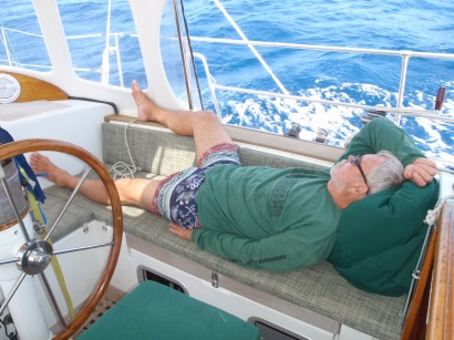
Most of this passage was very relaxing
We had to sail past the north coast of Venezuela which has become a very dangerous place. Our plan was to sail forty to fifty miles north of any of their islands. We did not transmit our position via AIS. We ran our deck-level running lights rather than our mast-head light. And we did not talk on the radio or turn on our radar. We wanted to slip by as quietly as possible.
Staying fifty miles offshore required that we head west-northwest rather than west. We sailed a course of approximately 285°, and we had an apparent wind angle of 120° to 130°. This was a great broad reach with more than a knot of current with us. We sailed just over 150 miles our first day.
On our second day, we had gone far enough north, and we needed to adjust our course to approximately west. The winds veered slightly south of east, and we were not able to maintain our reach. So we poled out the jib to starboard and waddled dead down wind with more than half a knot of current with us. The seas became closer and were on our port quarter making the ride a bit rolly. The sunset was very nice, and dolphins came to visit just before we ate dinner. They were small in size but large in numbers. Don’t know what kind they were. We decided to run our mast-head tricolor light rather than our deck-level lights this night because of the lesser power draw. We sailed just over 150 miles again our second day.
Our third day started with a course change to the southwest. We took down the pole and jibed the main for another broad reach for about ten hours. We put out the fishing gear, but we did not catch anything. We had good and fast conditions until around 12° 24’ N 067° 48’ W. As we headed down the east coast of Bonaire, the winds increased to 20 to 25 knots and the beam seas increased to 8 to 9 feet. We reduced sail to a double reefed main and staysail, and we had an uncomfortable ride to the bottom of the island.
When we rounded the bottom of the island, we got out of the seas, but it was still windy. And it was very dark with no moon at all. There are few navigation lights, and we found that a few that were present were not consistent with our charts, so we had an anxious trip up the leeward side of the island. Boats cannot anchor anywhere in Bonaire, so we made our way to the mooring field where we picked up a mooring shortly after midnight. We sailed just over 110 miles in 17 hours that day.
We had a very good passage other than those six hours along the east side of Bonaire. Our total passage time was 2 days 17 hours – or 65 hours. We traveled 418 miles in 65 hours for an average speed of 6.4 knots – much faster than our usual averages.
Follow us to our first stop in the ABC Islands, Bonaire