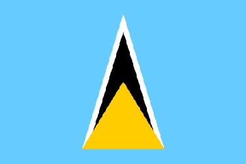
SAINT LUCIA
Saint Lucia is a sovereign island nation of the Lesser Antilles. It is one of the Windward Islands.
The history of Saint Lucia’s initial colonization is not clear. Some believe that Columbus landed on the island in 1502. However, some believe that Juan de la Cosa (Columbus’ navigator on a prior journey) landed there in 1499. Regardless, there was no European settlement until the 1550s.
The first European known to live on Saint Lucia was actually the pirate ‘Peg Leg’ le Clerc. He established a base on Pigeon Island from where he preyed on Spanish galleons. The Dutch arrived around 1600, and they established a base at Vieux Fort. They did not, however, spread their influence across the island.
The first permanent European settlement on the island was established by a French explorer, Jacques du Parquet, in 1643. The French colonizers began to cultivate sugar and they named the island after Saint Lucy of Syracuse. However, the British soon ousted the French, and they occupied the island from 1663 to 1667. Then the French again, and the British again… The French and British often battled over Saint Lucia (and other islands), and rule of the island changed fourteen times. The French ruled seven times, and the British ruled seven times. The Brits took control from the French for the final time in 1814.
The sugar industry was growing, but the population of Saint Lucia was contracting as much of the local population died from diseases introduced by the colonizers. More laborers were needed, and the British began importing enslaved Africans to work the sugar crops around 1763. Many enslaved Africans died from overwork and maltreatment, and even more were imported. This continued until the abolition of slavery in 1808.
Saint Lucia’s path to independence was slow. She became a British Crown Colony in 1814; however, she did not achieve independence until February 22, 1979. Saint Lucia is now an independent state of the Commonwealth of Nations associated with the United Kingdom.
Saint Lucia is a volcanic island just south of Martinique and north of Saint Vincent. The island is approximately 27 miles north-to-south and 10 miles east-to-west. Its landmass is just over 238 square miles.
It is a mountainous island with its highest point being Mount Gimie at 3,120 feet. There are two other mountains – the Pitons – that are far better known. They sit dramatically along the west coast of the island. There are tropical rainforests on the slopes, agriculture on the coastal fringe, and sandy beaches along much of the coast.
Gregory selling fruit from his boat in Rodney Bay
Inside Marigot Bay
The overall population is approximately 174,000. This population is mainly of African and African-European descent. Only 5% is European.
The primary language is English. Saint Lucia is the largest of the English-speaking Windward Islands. Ninety five percent also speak the local French Creole called “Patois”.
Seventy percent of the population is Catholic. The second most common religion is Seventh Day Adventist.
Saint Lucia’s primary source of revenue is tourism. So although they survived the global financial crisis fairly well, the subsequent double-digit decrease in tourism hurt them. The government is trying to decrease their heavy reliance on tourism by revitalizing the banana industry.
The currency of Saint Lucia is the Eastern Caribbean (EC) dollar. One US dollar is equivalent to approximately 2.66 EC.
The capital of Saint Lucia is Castries. Nearly one third of the population lives in Castries.
Soufriere town
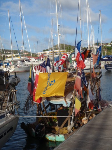
We arrived in Rodney Bay before daybreak on February 6 after our miserable Atlantic crossing. We anchored out in the bay and went to sleep. We moved inside the marina the next day.
We knew that we had a lot of repairs to do (there was also damage that we did not yet know about), so we signed up for two weeks. We were fortunate to have access to an affordable marina with a chandlery, hardware store, grocery stores (multiple), and fresh fruits and veges. We would stay for just over a month.
Our immediate project was repairing our refrigeration. Other big projects included sail repair, autopilots, and the creak.
We had the name and number of a refrigeration tech, Prudent, and he came by the same day we called him. He was quick, efficient, and expensive. But our galley was back in business. There was a sail loft in the marina, and Kenny was able to repair both of our damaged sails. We were able to rebuild/repair one of our autopilots, and we replaced the other. And we worked on the creak.
We cut four large holes in the cabinetry of our nav station. We re-tabbed everything that we could, and we tabbed joints that had never been tabbed. We also drilled lots of holes and injected epoxy. Then we drilled many holes in the cabin sole (not visible) and injected epoxy in them. We went for a test sail on March 5, and the creak was nearly gone.
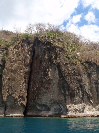
Bat cave in Soufriere Bay
Meanwhile, we also discovered damage to our staysail furler, wind generator, and steaming light. The furler is repaired, the wind generator needs a new board (will buy later), and we replaced the steaming light again. We had just replaced this last summer while in the Balearic Islands.
Boaters in the marina are nearly accosted by local workmen looking for maintenance work. We decided to hire two men to do two different maintenance jobs for us – cleaning our stainless and our bottom. Both were disappointing. The man we hired to clean the stainless did an incomplete job. It took Nita a full day to finish the job. The man we hired to clean our bottom did even less. It appears that he merely scraped around the waterline (the marina water is quite dirty, and we could not see anything below about one foot). We found a filthy bottom with countless barnacles when we jumped in the water a few weeks later. Disappointing.
Vendors also come around selling fruit and veges daily. Some come in their boats, and others walk the docks. We eat mostly veges, and we enjoy tropical fruits, so we were quite content.
During these weeks, we got to know the town of Rodney Bay and the surrounding area. It is a pleasant area, and the locals are friendly. Food prices were extremely high (even in comparison to the Med), so we did not eat out often. But we found a few good local places. We particularly liked the jerk chicken and the local roti with chicken curry.
We spent most of this month sleeping, cleaning, and doing repairs. And after a month, we were ready to move on. We left on March 8.
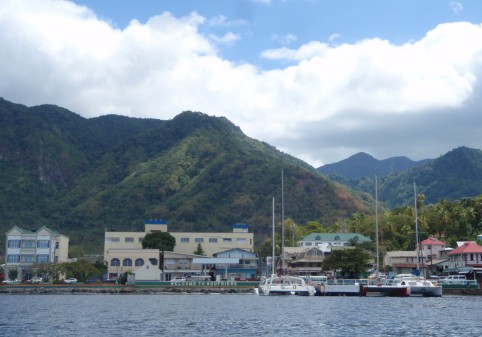
We were headed for Castries, the capital of Saint Lucia, which is a few miles to the south. However, we had done some more work on the creak, so we headed north for a ‘test sail’ out in the channel between Martinique and Saint Lucia. No creak. So we turned south and headed for Castries.
We sailed 13 miles and had a very nice sail. We think we are going to enjoy the sailing here.
Castries is a dirty little port, and we were the only boat in the anchorage. We went ashore to check out the market – reportedly the largest on Saint Lucia – but it was late in the day, and much of it was closing for the day. As the stalls were closing, the noise was building. There was very loud noise all night from a sound system on the near shore. We were looking forward to sailing away in the morning.
A French catamaran anchored quite close to us the next morning, and their anchor dragged almost immediately. We tried to move to avoid them, but we could not get out of their way. They had a bit of an attitude, but they finally realized that they were at fault, and they moved. We decided to move inside the bay and hang on a mooring for the night. We explored the little village surrounding the marina, and we found it uninspiring. We had a pizza for lunch and returned to the boat. John came by again and brought us some coconuts and a huge stalk of bananas. We left the next morning.
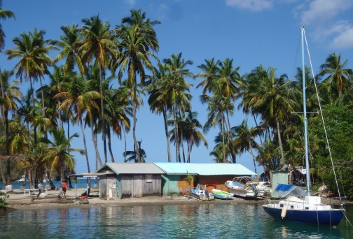
We had a boisterous nine mile motorsail south to Soufriere Bay. This is a marine management area in which anchoring is forbidden, and park rangers collect fees for hanging on their moorings. There are two charges for using the moorings: one or two days cost the same, and three to seven days cost the same. We thought we would probably stay more than two nights, so we paid for a week. We used every night.
This is a very scenic spot. It is a large natural bay across from the Pitons – two volcanic mountains right along the shore. A large fissure in the rock next to our mooring is a bat cave in which fruit bats live. And the water is relatively clear with coral and fish visible from the boat.
Soufriere town had no redeeming features for us. We had to pay someone to ‘watch our dinghy’ while we went ashore, but he did not watch it, and our outboard was damaged. We were accosted by pushy vendors at every turn. Their market was almost nonexistent – terrible food selection. So we chose to spend very little time in town.
Although our first night there was quite rolly, it quieted over the next few nights. And a very friendly fruit guy came out in his boat every day and kept us in good supply. We were eating soursop every day along with mangoes and John’s bananas.
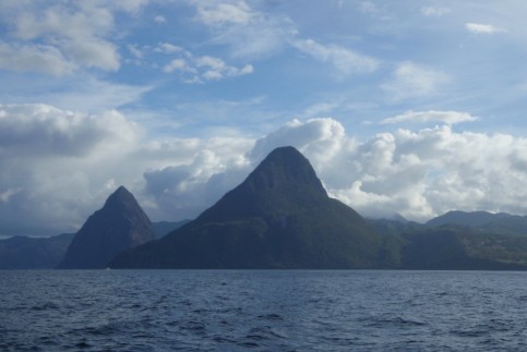
The beautiful Pitons
We got in the water planning to do some ‘fine tuning’ on our bottom, and we were very disappointed to find it was a mess. The bottom cleaner in Rodney Bay had pretty much ripped us off. So we spent hours on two different days cleaning our hull. Now she was ready to go the rest of the season.
This was to be our last stop in Saint Lucia, so we needed to check out with customs and immigration. Rather than going to the main harbor where we had had a bad experience, we took the dinghy to a small dock on the north end of town. That was a good decision.
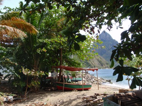
Fishing village in Soufriere
The guys at the dock still charged us to ‘watch our dinghy’, but we believe they did so. They took our garbage for us, and they were right there when we returned. Checking out was quick and easy, and we walked through an interesting fishing village along the way that we would have missed if we had gone directly to town.
We hung out and talked with the guys at the dock before returning to Passage. Nita was amused that the young men (maybe 20 years old) bragged about selling marijuana during the off-season. Bud talked with a slightly older man (maybe 30) who complained that the banks should, but did not, distribute money to the locals. Interesting perspectives.
Our six week visas were about to run out, and we were ready to move on. We left early the next morning, March 18, and headed for Saint Vincent.
Follow us to St. Vincent and the Grenadines or Grenada or return to our Caribbean page.