May 28 – June 19, 2015

This is a long sail that crosses three weather zones.  It can be a pleasant sail, or it can be unpleasant.  Despite our best planning, it was unpleasant for us.

We saw this sail as having three phases related to the three weather zones it crosses.  The first phase is from French Polynesia to the equator.  The second phase is across the equator and through the intertropical convergence zone (ITCZ).  The third phase is from the ITCZ to Hawaii.

The first and third phases of this sail are in waters that experience hurricanes in their respective summers.  Therefore, it should be sailed during the ‘change of seasons’ when neither winter storms nor hurricanes are likely.  That is November/December or May/June.  We chose May/June. 

It is particularly difficult to sail the rhumbline from French Polynesia.  Experience has shown that it is best to head northeast from French Polynesia and cross the equator around 145˚W.  This minimizes one’s time in the ITCZ (it is usually quite narrow at that longitude) and presents a sailable angle to the northern hemisphere’s tradewinds to Hawaii.  That was our plan.

Phase I – French Polynesia to the Equator

We left Bora Bora and French Polynesia on May 28 with a forecast of 18 knots of wind.  By the time we reached the tip of the island, the wind was blowing 17 to 27 knots and gusting to 35.  The seas were more than 10 feet and choppy, and we had current against us.  Conditions similar to this continued for five days, and the winds were too northerly for us to maintain our course. The winds went light on day six, and we motorsailed for a while.  However, we were acutely aware of our limited fuel and many miles ahead.  And day eight was calm enough that we caught up on chores.  Days nine and ten were still bumpy, but we were able to sail, and the current against us abated and actually turned in our favor about ten miles south of the equator. We crossed the equator on Sunday, June 7 at 1046Z at 144˚56’W.  We had sailed 1,105 miles in 9 days 15.5 hours for an average of only 4.77 knots – very slow for us.

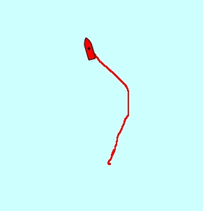
Crossing the Equator again

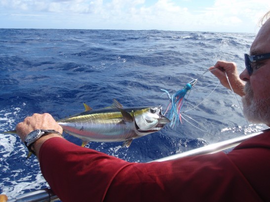
Small Yellowfin Tuna

Phase II – Equator through ITCZ

Once across the equator, we tried to sail due north until we got through the ITCZ and found the tradewinds.  Our first day (day 11 overall) became a motorsail through the morning and most of the afternoon.  Then the pushrod on our windvane broke, but we were able to repair it with only a minor delay.  Then we were able to sail through the night and most of the next day with a slight positive current. On day 12, we could see the clouds of the ITCZ as we neared.  We entered it around 03˚N with many squalls that night and the next day.  We had a particularly energetic squall at 0800Z on June 10 at 06˚N, and we found mostly clear skies on the other side.  We were through the ITCZ after only 30-some hours.

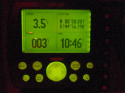
We continued north in search of the northeast tradewinds.  We sailed for a while, but our winds decreased and rain clouds moved in. We motorsailed until we found the trades at 09˚17’N on day 15. 

Phase II was 578 miles and took us 4 days 12 hours for an average of 5.35 knots.  This was still a bit slow but an acceptable pace.  We were particularly pleased that the ITCZ was only 3˚ wide and we got through it relatively quickly. 

Phase III – to Hawaii

On day 16 we finally felt like we were heading home.  We had a little light rain in the morning, then the winds and seas increased in the afternoon.  We had ½ knot of current with us, and we caught a small yellowfin tuna.  He was small enough that we would have thrown him back, but he was rather beaten up by the time we got him alongside the boat.  So we ate him. We have a rudder extension post that runs through our aft deck, and our windvane and tillerpilot use it to steer the boat.  That post experienced a spiral fracture on day 16, and we were suddenly without any self-steering (our new autopilot was not installed).  We were able to balance the helm overnight, and we rigged the self-steering to the wheel the next day. We had a few days of inconsistent winds and seas with some squalls.  Then on day 20 our winds increased to 30 knots overnight and the seas became bumpy again. We crossed our outbound track on day 21 at 1840Z.  We closed the loop at 19˚03’N/155˚57’W.  But we would not feel like our circumnavigation was completed until we returned to the Ala Wai Harbor in Honolulu from where we left more than ten years prior.

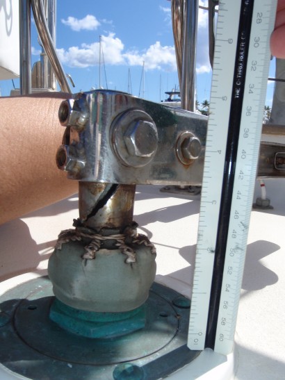
Fractured Rudder Post Extension

The winds and seas abated in the lee of the Big Island, and we motorsailed a course of 320˚ toward Honolulu. As expected, the winds and seas increased as we passed 40 miles downwind of the Alenuihaha Channel (between the Big Island and Maui).  The winds were 30 knots, and the seas were 12’. They eased when we got in the lee of Maui, but we also found 1 knot of adverse current.  The winds increased again to 24 knots in the Kaiwi Channel (between Molokai and Oahu), and there were a lot of boats on the water – more than we had seen in a long time. 

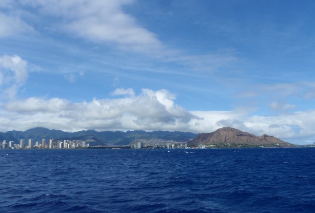
Approaching Honolulu

We pulled alongside the dock at the Hawaii Yacht Club at 0230Z on June 19.  Phase III had taken us 7 days 4 ½ hours to travel 1,029 miles for an average speed of 6 knots.

Overall we traveled 2,712 miles over 21 days 16 hours 48 minutes for an average speed of 5.2 knots – slow but the best we could do in the conditions.  We made countless sail adjustments, and we never flew a full main – always at least a single reef and often a double.  We fished only a few times, and we caught only one fish.  It was a trying passage, but it brought us home.

Return to our home page